

Поиск
Altai Krai

Kalmansky District

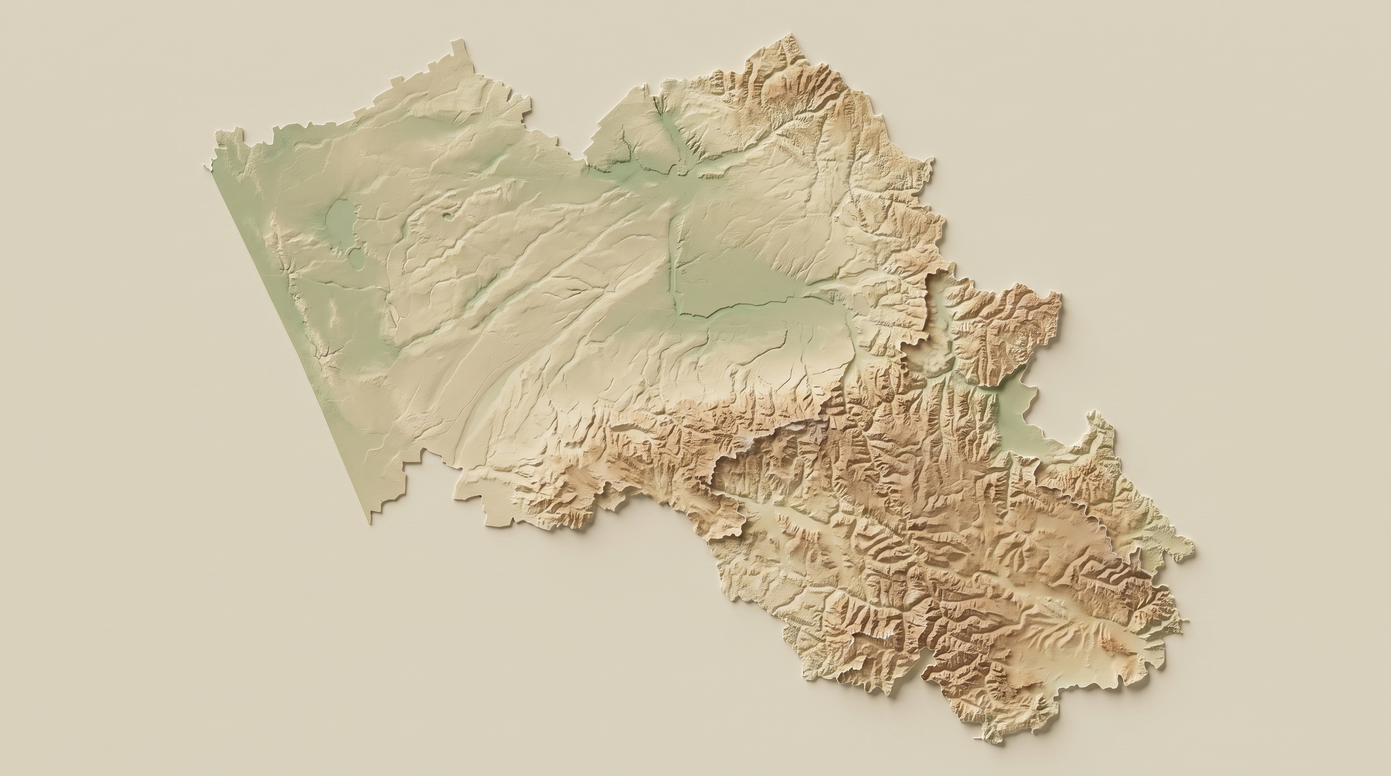
The villages of Kalmansky District form a zone of early Russian settlement in the Upper Ob region, where the forest-steppe landscapes of the Ob Plateau meet the massif of the Barnaul ribbon pine forest. Settlements founded in the 18th century by the first migrants, fugitive streltsy, and Old Believers stand alongside archaeological monuments of federal significance, including burial grounds of the Seima-Turbino type (Kalistratikha, Ust-Aleyka). In the Soviet period, the territory became a testing ground for agricultural and technical experiments: from the establishment of seed-production state farms and the basing of military aviation to the birth here of the chief designer of the T-90 tank. Today, the district's cultural code is embodied in active Orthodox parishes, school museums documenting the everyday life of the Siberian village, and festivals of rural culture where authentic crafts and traditions of communal mutual aid are recreated.
Dynamic Content Image

Aleksandrovka

Kalman District

Altai Krai

Dynamic Content Image

Altai

Kalman District

Altai Krai

Dynamic Content Image

Buranovo

Kalman District

Altai Krai

Dynamic Content Image

Zhdanovo

Kalman District

Altai Krai

Dynamic Content Image

Railway Barracks 260 km

Kalman District

Altai Krai

Dynamic Content Image

Railway Barracks 290 km

Kalman District

Altai Krai

Dynamic Content Image

Zimari

Kalman District

Altai Krai

Dynamic Content Image

Ivanovka

Kalman District

Altai Krai

Dynamic Content Image

Kalistratikha

Kalman District

Altai Krai

Dynamic Content Image

Kalmanka

Kalman District

Altai Krai

Dynamic Content Image

Kubanka

Kalman District

Altai Krai

Dynamic Content Image

Logovskoy

Kalman District

Altai Krai

Dynamic Content Image

Novobarnaulka

Kalman District

Altai Krai

Dynamic Content Image

Novoromanovo

Kalman District

Altai Krai

Dynamic Content Image

Novy

Kalman District

Altai Krai

Dynamic Content Image

Panfilovo

Kalman District

Altai Krai

Dynamic Content Image

Prudskoy

Kalman District

Altai Krai

Dynamic Content Image

Zimari Railway Halt

Kalman District

Altai Krai

Dynamic Content Image

Shilovsky Railway Halt

Kalman District

Altai Krai

Dynamic Content Image

Solontsovy

Kalman District

Altai Krai

Dynamic Content Image

Troitsk

Kalman District

Altai Krai

Dynamic Content Image

Ust-Aleyka

Kalman District

Altai Krai

Dynamic Content Image

Shadrino

Kalman District

Altai Krai

Dynamic Content Image

Shilovo

Kalman District

Altai Krai

Altai Krai

Troitsky District

The villages of Troitsky District occupy the landscapes of the Biysk-Chumysh Upland and the Bolshaya Rechka river basin, where ancient Bronze Age sites on Lake Utkul intersect with traces of industrial development and the repressive machinery of the 20th century. The territory of logging hubs and tie plants (Borovlyanka, Zavodskoye, Kulichye) became a place of forced labor for the repressed and a refuge for children evacuated from besieged Leningrad. The district's economic foundation was historically shaped around timber industry enterprises and poultry farms, whose workers were honored with the title of Hero of Socialist Labor. The district's true value today is revealed through working mechanisms of ethnographic preservation: the activity of folk ensembles ("Bolsherechye"), clay toy workshops, and the veneration of sacred natural sites such as the holy St. Nicholas spring and the "God's Lake" archaeological complex of Utkul.

Dynamic Content Image

Belovsky

Troitsky District

Altai Krai

Dynamic Content Image

Beloye

Troitsky District

Altai Krai

Dynamic Content Image

Borovlyanka

Troitsky District

Altai Krai

Dynamic Content Image

Borovlyansky

Troitsky District

Altai Krai

Dynamic Content Image

Vershinino

Troitsky District

Altai Krai

Dynamic Content Image

Gordeevka

Troitsky District

Altai Krai

Dynamic Content Image

Gordeyevsky

Troitsky District

Altai Krai

Dynamic Content Image

Gornovoye

Troitsky District

Altai Krai

Dynamic Content Image

Yeltsovka

Troitsky District

Altai Krai

Dynamic Content Image

Yeryomino

Troitsky District

Altai Krai

Dynamic Content Image

Zavodskoye

Troitsky District

Altai Krai

Dynamic Content Image

Zagainovo

Troitsky District

Altai Krai

Dynamic Content Image

Zelyonaya Polyana

Troitsky District

Altai Krai

Dynamic Content Image

Kipeshino

Troitsky District

Altai Krai

Dynamic Content Image

Klyukvenny

Troitsky District

Altai Krai

Dynamic Content Image

Krasnoyary

Troitsky District

Altai Krai

Dynamic Content Image

Kulichye

Troitsky District

Altai Krai

Dynamic Content Image

Leninsky

Troitsky District

Altai Krai

Dynamic Content Image

Lesnoy

Troitsky District

Altai Krai

Dynamic Content Image

Mnogoozyorny

Troitsky District

Altai Krai

Dynamic Content Image

Novoelovka

Troitsky District

Altai Krai

Dynamic Content Image

Ozero-Petrovskoye

Troitsky District

Altai Krai

Dynamic Content Image

Oktyabrsky

Troitsky District

Altai Krai

Dynamic Content Image

Pesyanka

Troitsky District

Altai Krai

Dynamic Content Image

Petrovka

Troitsky District

Altai Krai

Dynamic Content Image

Zagainovo Railway Siding

Troitsky District

Altai Krai

Dynamic Content Image

Vershinino Station

Troitsky District

Altai Krai

Dynamic Content Image

Stepnoy

Troitsky District

Altai Krai

Dynamic Content Image

Taldinka

Troitsky District

Altai Krai

Dynamic Content Image

Troitskoye

Troitsky District

Altai Krai

Dynamic Content Image

Tyumen

Troitsky District

Altai Krai

Dynamic Content Image

Ust-Gavrilovka

Troitsky District

Altai Krai

Dynamic Content Image

Utkino

Troitsky District

Altai Krai

Dynamic Content Image

Utkul

Troitsky District

Altai Krai

Dynamic Content Image

Khayryuzovka

Troitsky District

Altai Krai

Dynamic Content Image

Chervyanka

Troitsky District

Altai Krai

Dynamic Content Image

Yuzhakovo

Troitsky District

Altai Krai

Altai Krai

Slavgorod Municipal District

The villages of Slavgorod Municipal District form a distinctive cultural and landscape massif of the Kulunda Plain, where steppe expanses adjoin a system of mineralized lakes, including Lake Bolshoye Yarovoye and Lake Burlinskoye. The history of these settlements is determined by the large-scale resettlement movement of the early 20th century, the Stolypin agrarian reforms, and the expansion of the railway network, which brought together on this territory settlers from the central governorates, Ukraine, and the Volga Germans. The district's economic foundation historically rests on two directions: the industrial extraction of table salt, initiated on Burlinskoye Lake as early as 1768, and intensive grain farming. Today, the tangible and intangible heritage of the territory is reproduced through the activities of folk ensembles preserving distinctive calendar and wedding rites, the architecture of active Orthodox parishes, and memorial objects recording local historical events — from the Chernodol uprising of 1918 to the working days of the salt miners.

Dynamic Content Image

Andreevka

Slavgorod Municipal District

Altai Krai

Dynamic Content Image

Arkhangelskoye

Slavgorod Municipal District

Altai Krai

Dynamic Content Image

Ballastny Karyer

Slavgorod Municipal District

Altai Krai

Dynamic Content Image

Bursol

Slavgorod Municipal District

Altai Krai

Dynamic Content Image

Veseloye

Slavgorod Municipal District

Altai Krai

Dynamic Content Image

Vladimirovka

Slavgorod Municipal District

Altai Krai

Dynamic Content Image

Danilovka

Slavgorod Municipal District

Altai Krai

Dynamic Content Image

Dobrovka

Slavgorod Municipal District

Altai Krai

Dynamic Content Image

Yekaterinovka

Slavgorod Municipal District

Altai Krai

Dynamic Content Image

Znamenka

Slavgorod Municipal District

Altai Krai

Dynamic Content Image

Kuatovka

Slavgorod Municipal District

Altai Krai

Dynamic Content Image

Maksimovka

Slavgorod Municipal District

Altai Krai

Dynamic Content Image

Novovoznesenka

Slavgorod Municipal District

Altai Krai

Dynamic Content Image

Pavlovka

Slavgorod Municipal District

Altai Krai

Dynamic Content Image

Panovka

Slavgorod Municipal District

Altai Krai

Dynamic Content Image

Pokrovka

Slavgorod Municipal District

Altai Krai

Dynamic Content Image

Prigorodnoye

Slavgorod Municipal District

Altai Krai

Dynamic Content Image

Raygorod

Slavgorod Municipal District

Altai Krai

Dynamic Content Image

Selektsionnoye

Slavgorod Municipal District

Altai Krai

Dynamic Content Image

Semenovka

Slavgorod Municipal District

Altai Krai

Dynamic Content Image

Slavgorodskoye

Slavgorod Municipal District

Altai Krai

Dynamic Content Image

Aynak Station

Slavgorod Municipal District

Altai Krai

Dynamic Content Image

Zelenaya Roshcha Station

Slavgorod Municipal District

Altai Krai

Altai Krai

Tselinny District

The villages of Tselinny District form a stable agrarian-cultural massif of the Biysk-Chumysh Upland, where the landscape of the Chumysh and Marushka river valleys historically determined the logic of settlement. The territory consolidates two structural historical layers: the yam post stations and Old Believer farmsteads of the 18th century (Yaminskoye, Shalap, Sukhaya Chemrovka) and the large-scale infrastructural transformation of the 1950s–1960s associated with the Virgin Lands campaign. The district's tangible heritage is recorded in distinctive natural and economic dominants: from the "Yelanda Stones" and "Green Ring" geological monuments to industrial plantations of sea buckthorn and flax. The intangible tradition here is reproduced through concrete mechanisms of identity preservation: the revived religious processions in Sverchkovo, the "Golden Berry" sea buckthorn festival in Voyevodskoye, the "Myasnoy Zames" gastronomic festival in Druzhba, and the "Jam Session" rock festival in the district center — forming a model of a rural community that integrates historical memory with modern forms of cultural self-organization.

Dynamic Content Image

Bochkari

Tselin District

Altai Krai

Dynamic Content Image

Verkh-Marushka

Tselin District

Altai Krai

Dynamic Content Image

Verkh-Shubinka

Tselin District

Altai Krai

Dynamic Content Image

Verkh-Yaminskoye

Tselin District

Altai Krai

Dynamic Content Image

Voevodskoye

Tselin District

Altai Krai

Dynamic Content Image

Druzhba

Tselin District

Altai Krai

Dynamic Content Image

Elanda

Tselin District

Altai Krai

Dynamic Content Image

Lozhkino

Tselin District

Altai Krai

Dynamic Content Image

Lokot

Tselin District

Altai Krai

Dynamic Content Image

Marushka

Tselin District

Altai Krai

Dynamic Content Image

Ovsyannikovo

Tselin District

Altai Krai

Dynamic Content Image

Pobeda

Tselin District

Altai Krai

Dynamic Content Image

Popovichi

Tselin District

Altai Krai

Dynamic Content Image

Ruposovo

Tselin District

Altai Krai

Dynamic Content Image

Sverchkovo

Tselin District

Altai Krai

Dynamic Content Image

Step-Chumysh

Tselin District

Altai Krai

Dynamic Content Image

Sukhaya Chemrovka

Tselin District

Altai Krai

Dynamic Content Image

Khomutino

Tselin District

Altai Krai

Dynamic Content Image

Tselinnoye

Tselin District

Altai Krai

Dynamic Content Image

Chesnokovo

Tselin District

Altai Krai

Dynamic Content Image

Shalap

Tselin District

Altai Krai

Altai Krai

German National District

The villages of the German National District form a distinctive ethnocultural enclave in the landscape of the Kulunda Steppe, created during the resettlement campaigns of 1906–1911 on the basis of Mennonite and Lutheran communities from southern Russia and the Volga region. The tangible heritage of the territory is structured around forms of farming and construction adapted to steppe conditions: traditional homesteads combining residential and utility spaces under one roof, decorative embroidered sayings ("Sprüche"), and a network of specialized museums (in Galbshtadt, Grishkovka, Kamyshi) documenting the everyday life of Russian Germans. The intangible culture is reproduced through institutionalized mechanisms: the preservation of elements of bilingualism, language teaching, and the regular holding of ethnographic festivals (Sommerfest, Erntedankfest, Weihnachtsmarkt) and culinary marathons. A special layer of historical memory is recorded in the memorials to the victims of political repression and the Labor Army (Galbshtadt, Grishkovka, Kamyshi), creating a model of a territory where the cultural codes of early 20th-century colonists are integrated into the modern sociocultural landscape of Altai Krai.

Dynamic Content Image

Aleksandrovka

German National District

Altai Krai

Dynamic Content Image

Halbstadt

German National District

Altai Krai

Dynamic Content Image

Grishkovka

German National District

Altai Krai

Dynamic Content Image

Dvorskoye

German National District

Altai Krai

Dynamic Content Image

Degtyarka

German National District

Altai Krai

Dynamic Content Image

Kamyshi

German National District

Altai Krai

Dynamic Content Image

Krasnoarmeysky

German National District

Altai Krai

Dynamic Content Image

Kusak

German National District

Altai Krai

Dynamic Content Image

Nikolaevka

German National District

Altai Krai

Dynamic Content Image

Orlovo

German National District

Altai Krai

Dynamic Content Image

Podsosnovo

German National District

Altai Krai

Dynamic Content Image

Polevoye

German National District

Altai Krai

Dynamic Content Image

Protasovo

German National District

Altai Krai

Dynamic Content Image

Redkaya Dubrava

German National District

Altai Krai

Dynamic Content Image

Shumanovka

German National District

Altai Krai

Altai Republic

Kosh-Agach Aimak

The villages of the Chuya Steppe are the largest settlements of the republic's highest and driest district, the center of Kazakh culture in Altai.

Ничего нет

Altai Republic

Maima Aimak

The villages of the Katun valley in the immediate vicinity of Gorno-Altaysk — the suburban belt of the republic's capital with a long history of settlement.

Ничего нет

Altai Republic

Ongudai Aimak

The villages of the steppe intermontane basins of central Altai — a land of pastoral traditions and ancient kurgan burial grounds.

Ничего нет

Altai Republic

Turochak Aimak

The taiga northeast of the republic: the villages of the Lebed valley and the southern shore of Lake Teletskoye.

Ничего нет

Altai Republic

Ulagan Aimak

The villages of the Ulagan Plateau — a land of high-mountain lakes, the Katu-Yaryk pass, and the headwaters of the Chulyshman.

Ничего нет

Altai Republic

Ust-Kan Aimak

The steppe west of the republic: villages in the valley of the Kan River, at the border of the historical lands of Altai and the Kazakh steppes.

Ничего нет

Altai Republic

Ust-Koksa Aimak

The villages of southwestern Altai at the foot of the Katun Ridge — a land at the headwaters of the Katun, on the paths to Belukha.

Ничего нет

Altai Republic

Chemal Aimak

The villages in the middle reaches of the Katun — the historical breadbasket of the republic and its oldest center of attraction for travelers.

Ничего нет

Altai Republic

Choya Aimak

The villages of the northern foothills — the first land of the republic on the way along the Chuya Highway from the side of Altai Krai.

Ничего нет

Altai Republic

Shebalino Aimak

The villages of the foothill valleys in the republic's northwest — a land of old-timer settlements between the Kama and Sema rivers.

Ничего нет

The project was carried out with a grant from the Russian Science Foundation No. 26-28-20225 

Altai State University

Institute of History and International Relations

Department of World History and International Relations

61a Lenina Ave., Building M, 3rd floor, Room 309, Barnaul, Russia

© 2026 ФГБОУ «Алтайский государственный университет». Все права защищены.